Eco-Challenge: Providing Digital Solutions for Real-Time Competitor Tracking
Though impressive, the large dry-erase map housed at Eco-Challenge Fiji headquarters lacked something crucial – the ability to track the progress of competitors in real time. This led to our final contribution: data for a digital tracking web app.
Had the show focused on teams racing through major highways in the United States, the production team may have been able to utilize existing services like Google Maps, Waze, or any number of open-source applications. The Eco-Challenge production team selected the competition territory because of its remote nature, though, and its mélange of river rapids, thick jungle, swampland, and ocean tides rendered any online web-based live-tracking application out of the question. The solution: a custom built, offline functioning, real-time digital tracking application, intended to be displayed on a large touchscreen located in production HQ. Each team was given a GPS transmitter that sent their signal to the HQ every 15 minutes, allowing for near-real time tracking. Not only was their location information available, producers could also monitor information such as average speed, total time and total distance since the last GPS pin drop.
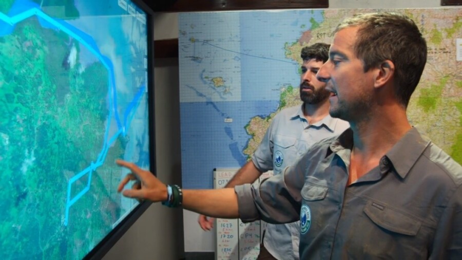
Bear Grylls and Race Operations Coordinator, Philippe Gautier, examine team positions on the web app. Image courtesy of Amazon.
Our first step was to reformat the previously generated custom maps into basemap layers optimized for web application functionality and display.
In addition to the 50K and 250K topographic and nautical chart basemap layers, we also prepared and delivered tile packages of satellite imagery and digital elevation data for integration into the web application.
With each dataset treated as a separate layer, users could choose which map they wanted to have displayed in the background, whether that be large scale topographic mapping (similar to what the competitors were using) or satellite imagery.
Moreover, the imagery was prepared in such a way that allowed for two separate satellite imagery datasets to be combined into a single tileset for efficient display: low resolution imagery is employed at higher zoom levels, while the high-resolution images allow course details to stand out when Grylls’s hand hits the touchscreen to zoom in on team activity.
Finally, the digital elevation model (DEM) was integrated behind the scenes to enable terrain profiles and 3D rendering of the course with the imagery or other layers draped on top.
Our work with Eco-Challenge is a reminder that the use of geospatial data is as varied as its applications. The unique challenge of supplying data for a tracking app using maps created and printed by our team to monitor competitors who are competing, overcoming, and, ‘occasionally,’ suffering on a route our sourcing abilities helped select, is not lost on us. We are incredibly proud to have been able to offer our services and expertise on such an exciting event.
To stream the incredible work of the MGM Studios production team and the competitors they chronicle, head over to: https://www.amazon.com/Worlds-Toughest-Race-Eco-Challenge-Fiji-Season/dp/B08BB8S8FJ, and https://ecochallenge.com to see more behind-the-scenes content.
Eco-Challenge: Identifying Custom Mapping Requirements for The World’s Toughest Race
With a route finalized and data inputs identified, it was time to decide precisely what kind of maps the Eco-Challenge production team required. The need for three distinct types of maps emerged – a very large wall map for production headquarters, a smaller-scale overview map for staff, and a set of competitor maps. All told, to fully meet the Eco-Challenge team’s diverse needs, East View Geospatial produced 11 custom maps and printed a total of 991 maps in-house.
Perhaps the most recognizable of these maps, to viewers, is the large dry-erase wall map at 1:50,000 scale, housed in production headquarters. This map provides a comprehensive, detailed representation of both the area of competition and ideal routes through it, complete with topography and bathymetry. The map can be seen almost immediately in the first episode as the host, Bear Grylls, unveils the large map and welcomes competitors. The ability to make notations in dry-erase marker is a feature that ties the strength of physical maps with something closer to a modifiable GIS. Its scale also helps impress upon viewers the scope of the race. To create this map, we utilized in-house GeoMosaicing expertise, stitching data together from 20 existing 50K maps over Fiji and custom made hydrographic charts.
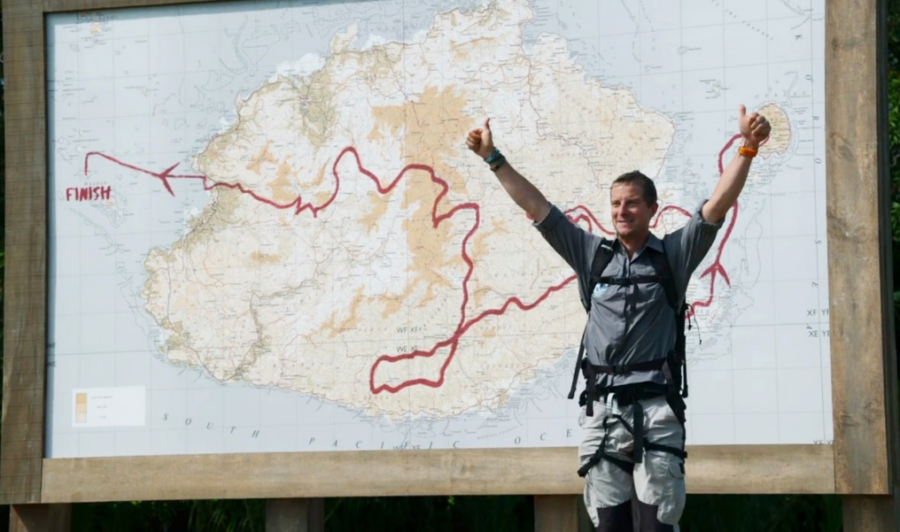
Host Bear Grylls unveils the course map as he welcomes the competitors. Image courtesy of Amazon.
For in-the-field staff, we developed a 1:250,000 scale course overview map. This map contains information not available to the competitors, like most efficient routes, transportation methods, and emergency points of interest. This information proved crucial as the production crew were up against the same natural hazards as their subjects, as detailed in the LA Times.
Finally, each team of adventure athlete competitors received a set of 9 custom maps and nautical charts. These maps consisted of mostly raw 50K data, organized by day and leg of the race. These maps are visible in the hands of teams as they break for navigation, or around their necks in clear bags as they progress through the race. Their misreading of these maps is also apparent from time to time, illustrating the limits and advantages of physical maps and the skills necessary to utilize them.
Eco-Challenge: GeoConsulting and Essential Data Identification
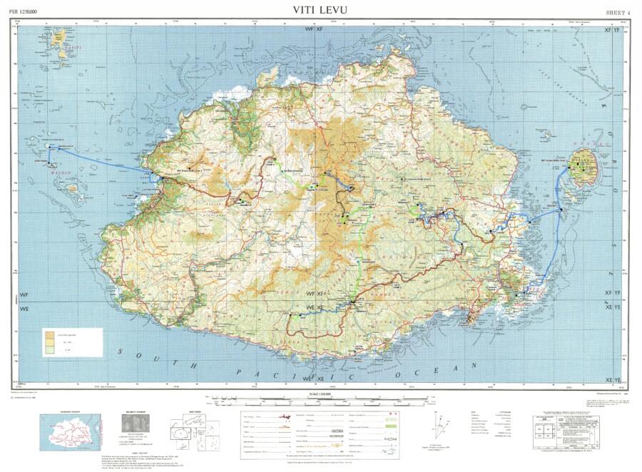
The EVG-made custom map of Fiji that contains elevation data, 50K and 250K topographic information, and bathymetric data.
A few months after East View Geospatial supplied mapping to the Eco-Challenge production team, their proposed route was given the go-ahead. With a clearly defined area of interest, the conversation turned to data inputs, and East View Geospatial’s well-honed GeoConsulting abilities took center stage.
When EVG does consulting for its clients, the goal is two-fold. We want clients to know the full extent of their options, and we want to leave them better educated than before our engagement.
Eco-Challenge needed custom maps created for competitors and production personnel. As these maps differ in purpose, the necessary data was far-ranging. Knowing what ‘ingredients’ to combine to build certain kinds of maps is knowledge gained from decades of experience; anticipating other information is another hallmark of that expertise.
When the team mentioned their desire to create a web app to track competitors’ movements in real time, for example, we leaned on our unparalleled collection and supply network to procure remotely sensed data including satellite imagery and terrain data. Without this information, 3-D visualization would not be possible. More information on this portion of the project will come in future blogs.
In the end, we provided national topographic maps at 50K and 250K scale, bathymetric data derived from nautical charts (essentially sea-floor terrain), multi-resolution satellite imagery, and elevation data.
The production team finalized the routes during this phase, and we moved on to determining the precise kinds and number of maps needed for the production team and competitors.
Eco-Challenge: Providing Authoritative Data For Location Evaluation & Planning
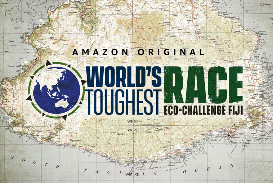
Image courtesy of Amazon.
In late 2018, the Eco-Challenge scout team moved through the lush valleys and dense jungles of Fiji, evaluating the island for their upcoming joint television production with MGM and Amazon Studios, World’s Toughest Race: Eco-Challenge Fiji.
The competition pits 66 teams from around the world against each other in a round-the-clock race over, into, and through hundreds of miles of Fijian wilderness. To navigate the jungles, beaches, and rocky faces of the island, the teams use only paper maps and a compass. To track the teams, stay organized, and create compelling television, the production crew required a far more diverse array of geospatial resources.
Before embarking on their evaluation mission, Eco-Challenge turned to East View Geospatial.
The team’s first need: detailed, authoritative maps of the territory they were scouting to define optimal routes, plan the checkpoints and emergency stations, etc. Our partnership with National Mapping Agencies in Fiji, combined with our comprehensive collection of physical and digital mapping options, enabled us to offer quality information to the team simply and efficiently – precisely why we do things the way we do.
We procured and supplied a collection of 1:50,000 and 1:250,000 national topo maps of the island. Our existing partnership with the Ministry of Lands and Mineral Resources of Fiji streamlined the process of collecting the geospatial information the team needed, and scouting commenced.
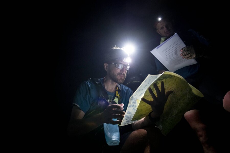
Image courtesy of Amazon.
Our collaboration deepened as the project’s needs grew and EVG’s comprehensive capabilities were put to use. Over the course of our engagement with Eco-Challenge, we would collect and distribute existing information, identify and compile comprehensive data inputs, craft custom map products for specific purposes, and even print-on-demand the physical maps needed for competitors, set-dressing, and emergency back-up purposes.
The scouts finished their work using maps we provided, and the project’s complexity increased. Now the team would need to gather more data inputs to create the mapping systems necessary to monitor and execute the production. Our next blog will outline the needs of the production team and how EVG provided the ultimate geospatial solutions.


