There is more data in the palms of our hands than ever before, and even for industries built on selling access to now-free information, there is a silver lining. Access to publicly available data is heightening everyone’s imaginations, and, in doing so, is stimulating demand for further expertise in data science and technology to harness its full potential.
For specific outcomes, though, expertise is needed. Many companies and individuals, while cognizant of this open data revolution in which we find ourselves, still need assistance in both sourcing the appropriate data as well as leveraging it to reap intended outcomes. To illustrate the demand for and value of data science and technology expertise, detailed below are recent projects leveraging open-source data.
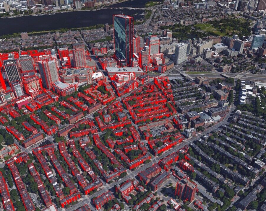
Building height data produced by EVG, shown in red, compared to real building size to show accuracy.
Satellite and aerial imagery represent another data type that has become exponentially more pervasive in the public domain, and these remotely sensed datasets can enable the creation of innumerable derivative products and applications. Good examples of these include satellite-borne images from the Landsat Missions, made available through NASA and USGS, and Sentinel-2, made available through the European Space Agency. Many are unaware of the existence of such imagery. Or, even if they are aware, they may struggle to exploit the data into meaningful outcomes. That’s where solution providers, like East View Geospatial, come into play.
In another notable case, EVG was able to utilize Landsat imagery over Costa Rica from 2015-2018 to perform a detailed change detection study on behalf of our client. This publicly available imagery allowed us to quickly analyze land cover and canopy changes over the country during a time when Costa Rica had experienced two major hurricanes. The data outputs we provided allowed the client to evaluate the extent of the environmental impact as well as their post-disaster response.


Satellite imagery over Costa Rica compared to land use/land cover data over the same area.
In both cases, EVG’s knowledge of public data & access to difficult-to-source data through National Mapping Agencies combined with our technical expertise enabled an agile solution. Aggregating free data, analyzing, conflating it with other datasets and delivering on a plan of action is something that has become integral to our operation since its inception. Growing access to free data has ushered out many traditional models of selling data but, most importantly, it has presented new opportunities to bring forth creative solutions to today’s most difficult challenges.


